UCI researchers help residents from Tijuana to Newport Beach plan for higher waters via the FloodRISE project
Silvia Rico Medina and her family live in a cinder-block hut they built by hand at the bottom of one of Tijuana’s poorest canyons. Their roof is a sagging plastic campaign sign for a Mexican presidential candidate. Her sons, 7 and 10, scamper across dried mudslides that nearly buried their old home next door. When a storm blows, rain whips sideways through the makeshift windows and water starts to rise in the dirt road out front.
UC Irvine engineers say that with climate change bringing fiercer storms to this part of the world, Medina’s modest home and her neighbors’ could well be destroyed.
Two hours and 100 miles north, Lee Sutherland sits on his back patio on Newport Beach’s Balboa Island, enjoying the sunshine but keenly aware of the future. The low-lying enclave is ringed with huge storm drains, but when a winter high tide combined with a heavy squall hit the island in 2010, waves lapped over the top of the island seawall, threatening multimillion-dollar homes. Thanks to climate change, those “king” tides could well be tomorrow’s normal tides here, increasing property owners’ risk even more, according to UCI civil engineers.
Flood warning
As global warming takes hold, melting glaciers are raising sea levels and more extreme storms could become the norm, which climate scientists have long predicted. While international leaders will debate whether to finally slash greenhouse gases at the 21st United Nations Climate Change Conference in Paris this December, some local communities are grappling with what is already at their front door.
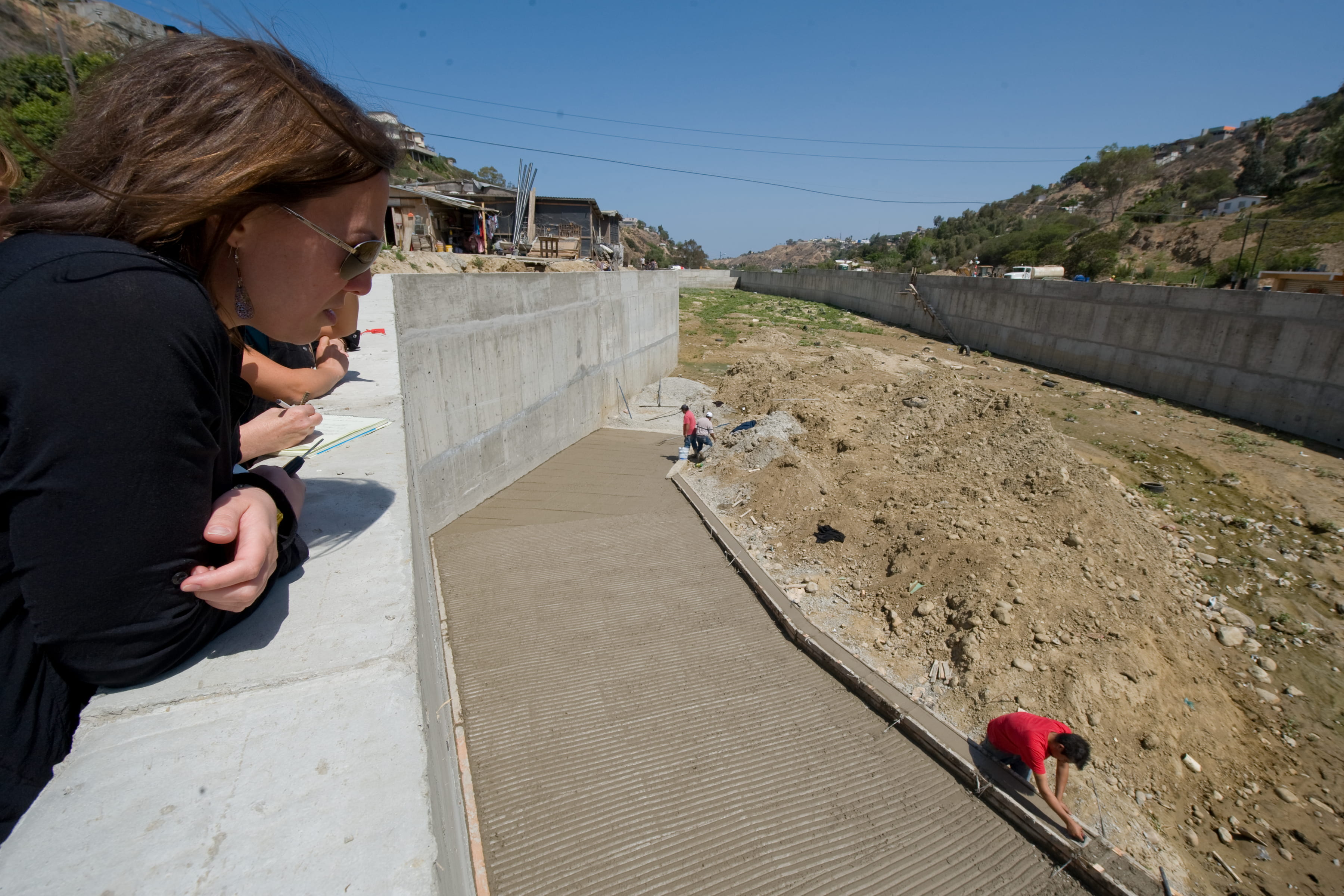
Goodrich and other UCI staff and students tour sites in the Tijuana River National Estuarine Research Reserve and in the city of Tijuana as part of a study on flooding and sediment relocation.
Steve Zylius / UC Irvine
UCI professors and students across a wide range of disciplines are stepping up to help via the Flood-Resilient Infrastructure & Sustainable Environments – or FloodRISE – project, a five-year, $2.7 million effort funded by the National Science Foundation.
Now in its second year, FloodRISE seeks to educate residents and community leaders about increasing risks on a parcel-by-parcel basis and work with them to find possible solutions.
UCI engineers have crawled through culverts and used low-flying plane data to devise new models that pinpoint what kind of inundation residents can expect in coming years. That’s the first step. Social ecologists, psychologists, economists and students are also knocking on doors and sitting at kitchen tables. The aim is not to impose ideas but to interact with affected communities to help them design suitable, effective strategies.
“Here’s the big thing: All around the world, there’s a top-down approach to climate change. Scientists and government agencies are telling people what’s going to happen,” says FloodRISE co-director Richard Matthew, professor of planning, policy & design. “Flooding is a huge problem, and it’s going to get worse – our infrastructure is not equipped to handle it. There will be $1 trillion annually in economic damage due to flooding globally by 2050, according to the World Bank. But there’s also this huge gap between what scientists know is happening and what people are willing to do.
“Our project is unique because we’re learning from the communities about what they value, where they see problems and how they respond to scientific evidence. What sort of measurements or percent chance of flooding over the next decade or the next century will be valuable for them? The end result could tighten this huge gap.”
Building better models
FloodRISE is the brainchild of Brett Sanders, professor and chair of civil & environmental engineering, who realized that he and his students could use new technology to map flood risk with greater accuracy than overly broad or outdated federal maps. And he didn’t want to just come up with numbers.
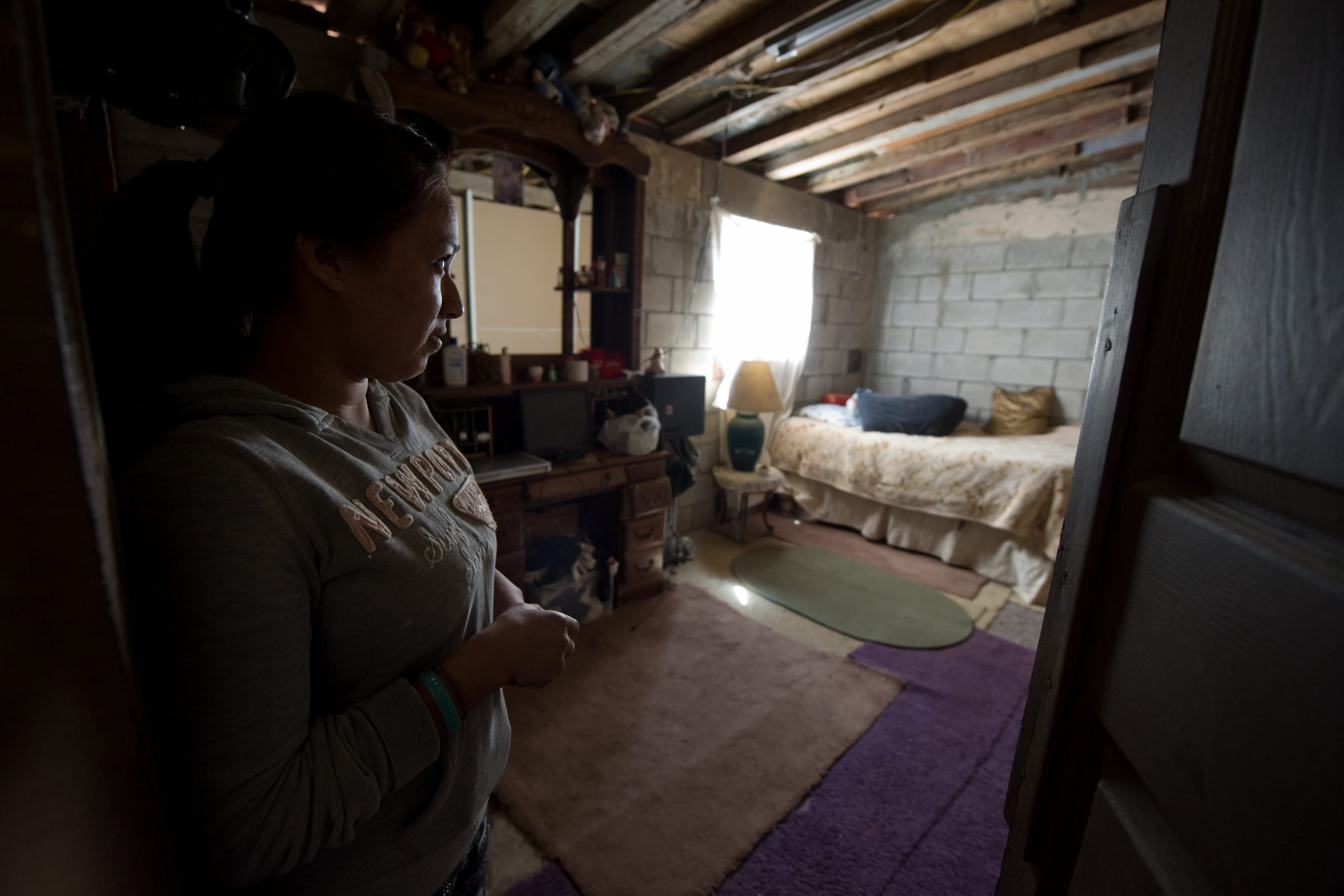
Los Laureles Canyon resident Silvia Rico Medina shows UCI FloodRISE participants her bedroom, which floods when wind-whipped rain blows in sideways through the window. The roof, made from a plastic presidential campaign sign, also leaks.
Steve Zylius / UC Irvine
“Standard engineering courses offer highly specialized skills for hydrologic analysis,” Sanders says. “FloodRISE expands that context to also offer something very valuable to real people. Every community has different demographics, different economics, different factors of so many kinds.”
He approached Matthew, and they devised the strategy to develop climate-related flood models, to inform potentially affected residents and local policymakers without panicking them, and to help craft possible answers – from building higher seawalls to moving if necessary.
Baseline surveys have now been completed in both Tijuana’s Los Laureles Canyon and Newport Beach’s coastal areas. Detailed flooding maps have been given to residents, and adjustments will be made based on input received from them.
That’s crucial, says Ana Xochilt Eguiarte, binational liaison at the Tijuana River National Estuarine Research Reserve, who’s been working in flood-prone Los Laureles Canyon for six years. She’s tackled such projects as using hundreds of tires dumped in the watershed to build retaining walls on badly eroding hillsides.
Forging relationships
Community partners are a key aspect of FloodRISE. Newport Beach and the Tijuana River estuary area were selected because they offer starkly different demographics and because faculty and students have strong pre-existing relationships there.
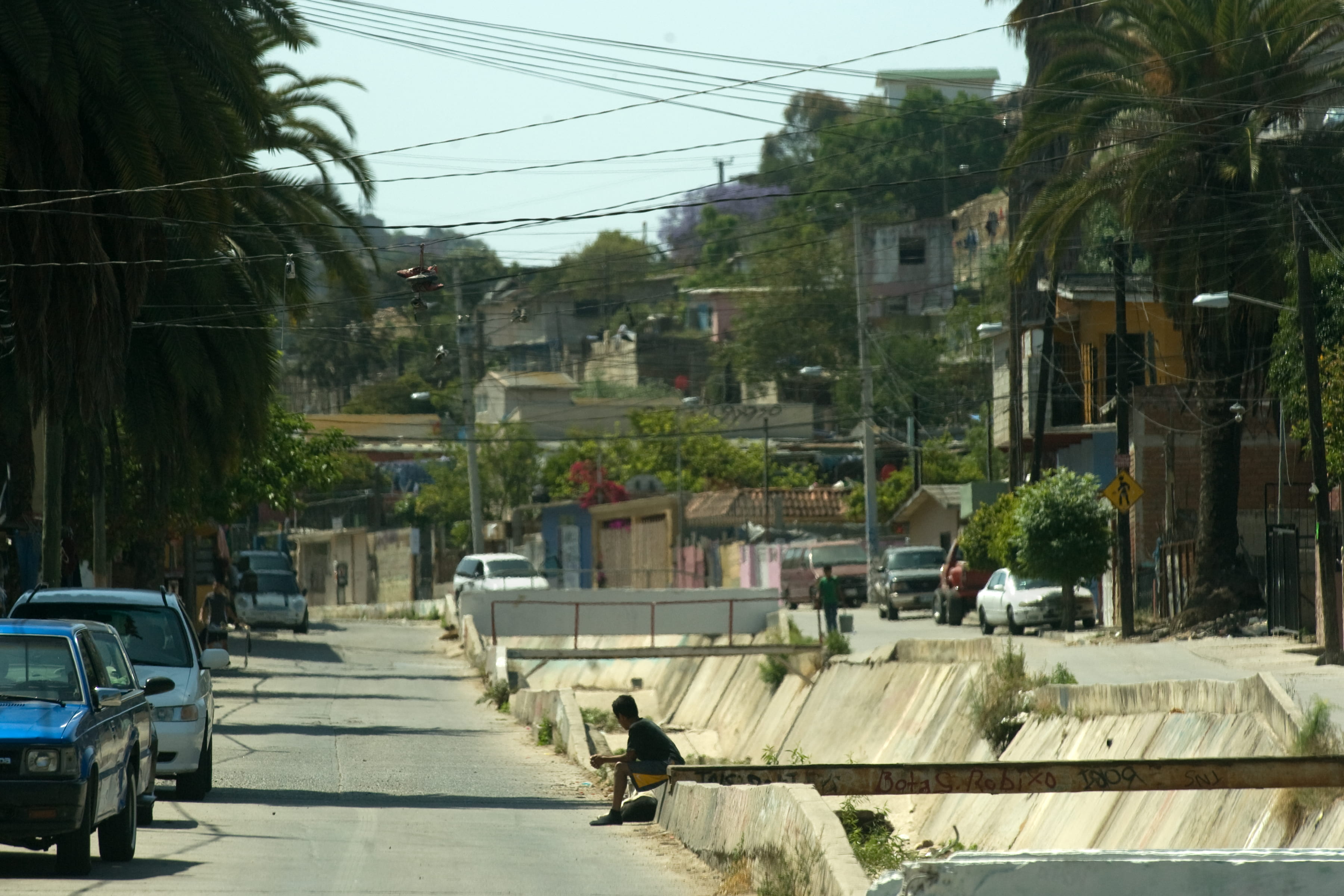
A drainage channel runs down the middle of flood-prone Los Laureles Canyon in Tijuana, Mexico.
Steve Zylius / UC Irvine
UCI social ecology doctoral student Kristen Goodrich, who has been at the research reserve since 2009, knew that Eguiarte might be able to help. Eguiarte recruited five local women who had done government census work to conduct the lengthy initial surveys for FloodRISE.
As part of the process here and to the north, residents were asked about their experiences with heavy rain, along with questions about everything from age and occupation to what route they usually take to leave home.
Eguiarte says the first phase has already empowered people often consumed with just trying to survive.
“These are people who are living day to day, figuring out how to find money for food. Rain is just part of the cycle,” she says. “But since this survey, they know they have to be ready for the future, they have to find another way. They want to be part of planning their own future, of training – whatever it takes.”
It’s also important, Eguiarte notes, “for professors to try to see outside the university, away from their computers, and to help a little bit.”
Victoria Basolo, professor of planning, policy & design, agrees: “For the graduate students and myself, being in Los Laureles, walking the rugged streets and slopes of the canyon, observing training in one of the hillside homes and seeing the perilous conditions firsthand has been a great learning experience.”
A grad student’s quest
Much of the UCI modeling is being done by Adam Luke, who’s pursuing a master’s degree in civil & environmental engineering. He’s thrilled with the FloodRISE project, which builds on work he did as an undergraduate in the Midwest.

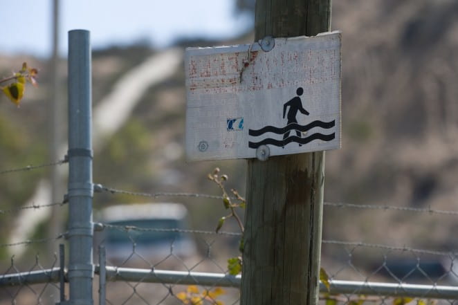
This sign warns of rising waters in Los Laureles Canyon. UCI engineers have devised new models showing that more severe storms caused by climate change will mean even greater flooding here.
Steve Zylius / UC Irvine
Traditional flood maps rely on relatively crude geographic information systems data and older, simplistic computer models. But new light detection and radar techniques and advanced computer models offer higher-resolution, fully three-dimensional representations of rivers and their floodplains.
Instead of regional maps showing areas that could end up either inside or outside a flood zone, Luke can model how the height and velocity of water in a particular flood channel could rise by the minute during a storm.
“We can help people with this information,” he says. The toughest conclusion he’s made so far is what could happen to residents of Tijuana’s Los Laureles Canyon.
In harm’s way
“All these homes would be washed out in a hundred-year flood,” Luke says, pointing to parcels clustered at the bottom of steep road embankments on one side and badly eroded scrub hillsides on the other.
Medina’s home sits in this hazard zone. A rusted warning sign on the street shows a block-figure pedestrian slogging through floodwater up to his knees. Medina is aware of climate change but has no idea what to do about it. “God only knows,” she says. “I just want to be relocated.”

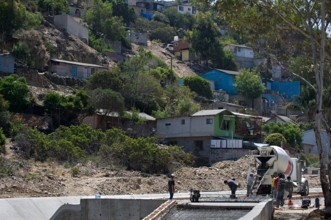
Workers build a retention basin in Los Laureles Canyon, one of several municipal basins being installed to help control floodwaters. Unchecked growth has eroded the already steep, slide-prone hillsides.
Her husband, Eduardo Quezada, works long hours making dental implants, earning as little as 15 pesos for a tooth that may ultimately cost a patient $1,000. Her in-laws have lived in this spot for two decades. They don’t know where else to go.
Rapid new development is making the situation worse – including, ironically, homes being built by a church group at the upper end of the canyon: Slopes are being carved up, exacerbating erosion and mudslides for those below. It rarely rains, but when it does, downpours are heavy, Goodrich notes. Sediment, sewage, old tires and other trash are swept through the canyon by the raging waters, blocking storm drains and overflowing drainage basins.
“In Los Laureles, the conditions of the natural environment interact with the development of the built environment to produce a complex, hazardous place to live,” says Basolo, who has also studied residents’ behavior in hurricane- and earthquake-prone New Orleans, Los Angeles and Miami-Dade County.
Abigail Reyes, UCI’s Sustainability Initiative director, adds that if people like Medina and her neighbors formed community aid groups and organized to lobby municipal officials to better protect them, for instance, it could help.
UCI’s flood risk maps will be given to IMPLAN, a Tijuana planning agency, to assist in the construction of retention basins and other flood prevention infrastructure. There are no easy answers, but there’s newfound knowledge and hope.
Newport’s threatened coast
In Newport Beach, undergraduates called FloodRISE Hazard Scholars earned credits for conducting baseline surveys last spring. Sutherland, of Balboa Island, was the first person questioned by the UCI team.
“I think it’s great. The more information we can get, the better. We need it,” says the retired aerospace engineer, who has lived on the bay since 1991. “When we bought our property, we didn’t even think about global warming … but we need to think about it now.”
Not everyone shares his opinion, even after seeing the updated flood maps. An initial review of the survey data shows more of a split here than in Tijuana among respondents about how big a risk they think climate change will pose. The difference may be due to demographics, including greater personal wealth, political affiliation and absentee property owners.
“My guess is that Newport Beach has people who are very confident about their abilities and resources, who feel they will be able to handle whatever comes their way. They’re not interested in having government involved,” Matthew says.
City officials and Balboa Island homeowner associations are already strategizing about replacing and possibly raising aging seawalls, says Public Works Director David Webb. But there are debates about who will pay, how high the walls should be and other issues that matter deeply to residents. UCI social ecologists and sustainability experts are seeking to meet with officials, local businesspeople and residents to offer help. Webb thinks it may prove valuable for the academics too.
“I think it’s a good real-world exercise,” he says. “Some civil engineering students are trained how to address worldly problems but can’t make the connection to how that affects us right down the street. It’s not just a civil engineering project: There’s science, there’s economics, there’s perception vs. reality, there’s politics, there’s emotions, there’s questions about people’s harbor views going away. We have to figure out how to balance all of that.”
In both Newport Beach and Los Laureles Canyon, focus groups of residents, businesspeople, officials and nonprofits are being formed as part of the next phase.
“I’ve been so impressed by how rapidly the FloodRISE team has mobilized to implement the research and engage with people in these communities,” says project manager Kimberly Serrano. “The best work is yet to come.”
– Janet Wilson, UC Irvine